Sample Projects
Explore Our projects
Amazing Projects Accomplished
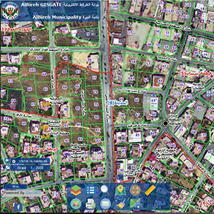
AlBireh Web GIS System
This project aimed at building a web GIS application used by municipality officers for managing and administering municipal data (parcels, buildings, quarters, blocks, manholes, solid waste containers, …etc), and accessed by public people through internet for general searching and querying purposes.
LWSC Web GIS App
The system focused managing and administering spatial and non-spatial data related to all settlement stages implemented by LWSC including land parcels, cadastre blocks, quarters, settlement orders, parcels’ owners, buildings’ owners, buildings’ units, and objections. Backed with a powerful reporting and printing engine the system is being used for issuing official reports related to the institution.
YATTA Web Mapping Portal
Building a database for storing all municipality spatial data, in addition to setting up a publishing engine for publishing data from database in form of web services, that is consumed by a custom web GIS application. The application included modules for linking licensing data to spatial data, in addition to integrating ownership tabular data to assets.
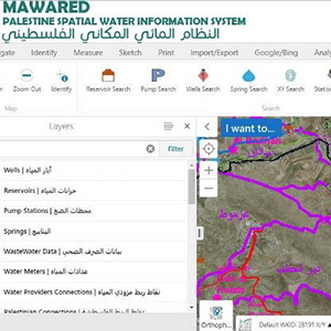
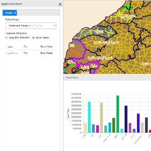
PWA Spatial Information System
In this project, the main layers of interest for PWA were collected and published via web GIS application (wells, reservoirs, pumps, water service providers, water connections, …etc) and accessible by PWA’s officers for viewing, querying, and editing data online, in addition to developing special modules for reporting and charting in order to empower users with analysis tools.
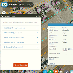
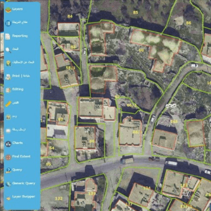
Tubas Web GIS Portal
Municipal Web GIS system for visualizing and managing municipal geospatial data; in addition to linking tabular (non-spatial data stored in relational database tables) to the system like properties owners. The system is designed to be used by municipality staff in several departments like GIS, engineering, and customer services departments for handling daily inquiries and workflows.
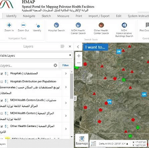
Interactive Web Health Mapping
Web mapping application was developed for managing all the collected data for all the registered hospitals, health centres, and clinics, this application is being used for entering the data related to the associated health facilities. In addition to developing special modules for advance search, charting, time-aware analysis, and coverage by catchment area analysis.
And More
Awsome Projects
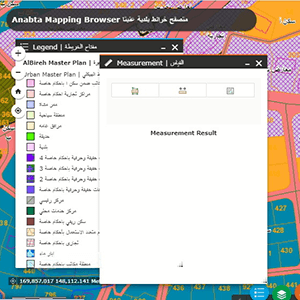
Anabta Designer
Developing a web GIS application used by municipality officers for managing and administering municipal data (parcels, buildings, quarters, blocks, manholes, solid waste containers, …etc), and accessed by public people through internet for general searching and querying purposes.
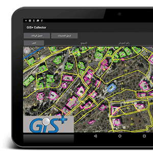
PFU Mobile Collector
Building a mobile application that affords offline geolocation (positioning), offline geospatial data collection, and online synchronization with the server and the database. The application is being used by PFU’s field surveyors for capturing all agricultural data related to the registered farmers
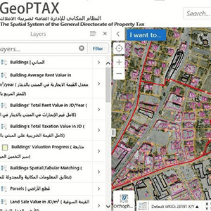
GDPT PropertY Tax Mapper
Delivering a solution for automating the process of property valuation; with focus on applying GIS principles in simulating the valuation standards applied on a huge number of properties in addition to building advanced GIS editing modules which focused on updating the GIS data at the database level in real time.
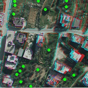
MOLG Digital Photogrammetry
Delivering Aerial Imagery services for 23 municipalities and village councils. with focus on aerial imagery and photogrammetric processing, aerial triangulations, tie points generation, control points measurement, DEM Extraction, DTM generation, contour lines production, orthophoto extraction, and feature extraction for all objects that can be used in urban planning.
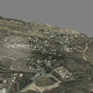
Surda 3D Mesh
Full photogrammetry project for Surda-Abu Qash Municipality at 5 cm resolution, 10 cm horizontal accuracy, and 15 cm vertical accuracy. In addition to Aerial Triangulation DEM and DTM processing, contour extraction, and full feature extraction, 3D Mesh was generated for the whole area of interest (8400 donums=84 Km2)
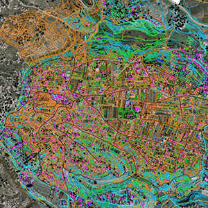
BSM Features Extraction
Delivering Aerial Imagery services for Beit Saour Municipality. The project delivered aerial imagery and photogrammetric processing, aerial triangulations, tie points generation, control points measurement, Digital Elevation Model (DEM) Extraction, Digital Terrain Model (DTM) generation, contour lines production, orthophoto extraction, and feature extraction.